Resident
Identify a route or change in level. What can a photograph show about shared space, and what must a legal record explain?
 GEÇMİŞİN
DOUGGA / TUNISIA
Beyond the Roman columns lie an older town, two legal communities and the names of people who worked in stone, wood and iron.
Read Dougga from hillside to public square, from a theatre photographed in modern use to a bilingual inscription. Buildings, citizenship and craftsmanship reveal different ways of belonging to one town.
Choose a viewpoint and keep observation apart from interpretation.
Identify a route or change in level. What can a photograph show about shared space, and what must a legal record explain?
Connect a building to its named financial supporter. Keep the date of construction apart from the date of a photograph.
Follow the bilingual inscription record. Separate a named task from an uncertain reading or attribution.
READING 01
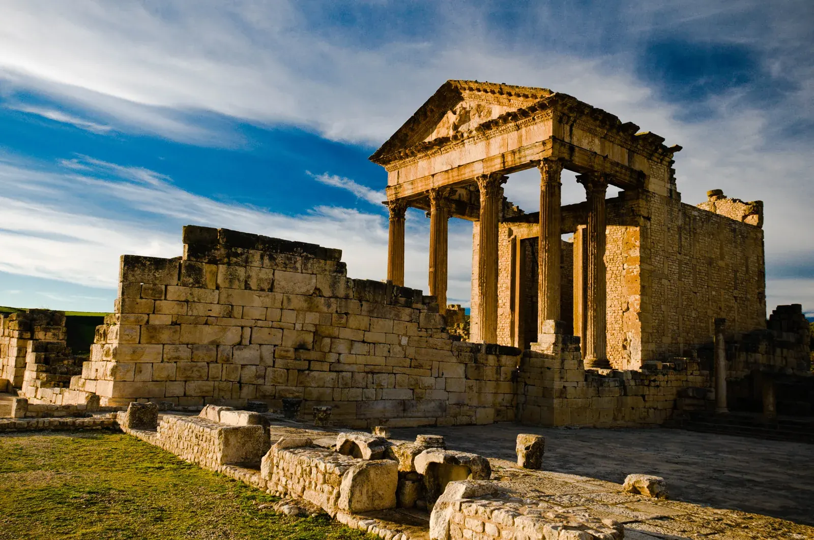
At first the columns win. The pediment cuts a sharp line against the sky; sunlight brightens one face of the stone while leaving another in shadow. Lower your gaze and the steps, low walls and changing ground levels enter the story. Knowing a city only through its tallest monument is rather like knowing a book by its cover. At Dougga, the journey begins when the eye moves outwards from the columns.
The ancient name of this Tunisian town was Thugga. UNESCO emphasises that its Roman monumental appearance developed within a largely Numidian urban fabric. New buildings did not occupy a blank page: they entered a place already shaped by routes, settlement and human relationships. Recognising a Roman temple is therefore the beginning of a question, rather than a reason to label everything around it Roman.[1]
Imagine walking on sloping ground. Reaching a destination involves climbing or descending as well as turning left or right. Even a nearby building changes its relationship to you as your viewpoint shifts. A photograph cannot assign every stone to a period, but following its levels helps us see a city rather than a row of façades. The hillside invites the gaze into the architecture.
Chronocarto presents research tracing the monumental centre through eight phases, from a Numidian agora to a Byzantine fortress. Plans, architecture and inscriptions are considered together. Alongside asking when a stone belongs, ask what a later generation changed or continued to use. The town becomes a set of relationships repeatedly rearranged over time, rather than dates simply stacked on top of one another.[3]
READING 02
Think of passing between the Capitol's columns. The opening through which we now see the sky once helped frame public life. INP dates the temple to AD 166 or 167, identifies its dedication to Jupiter, Juno and Minerva, and names its financial supporters: Lucius Marcius Simplex and his son. Gods and benefactors thus enter the same account of a building.[2]
Who shared this town? UNESCO describes an indigenous community and a community of Roman citizens, legally distinct but coexisting in the same town and territory for about two and a half centuries. Chronocarto identifies the institutional pairing as pagus and civitas. These legal identities form a layer of urban life that a photograph of columns cannot make immediately visible.[1][3]
It may be tempting to turn that legal distinction into two coloured neighbourhoods on an imaginary map. Resist the shortcut. Coexistence in one town does not establish a boundary through its streets. The discussion accompanying Khanoussi's 2003 presentation rejects the notion of two separate urban areas; its bibliographic record is linked below, with the limits of this edition's access stated. UNESCO's independently readable account likewise places both communities in one town.[4][1]
Return to the first photograph without drawing invisible walls across it. Imagine people approaching a shared space with different rights, duties and ambitions. A donor's name, a civic status and a meeting place each open a different question. Reading the relationships alongside the grandeur makes a monument more alive, without pretending that the picture reveals every relationship.
READING 03
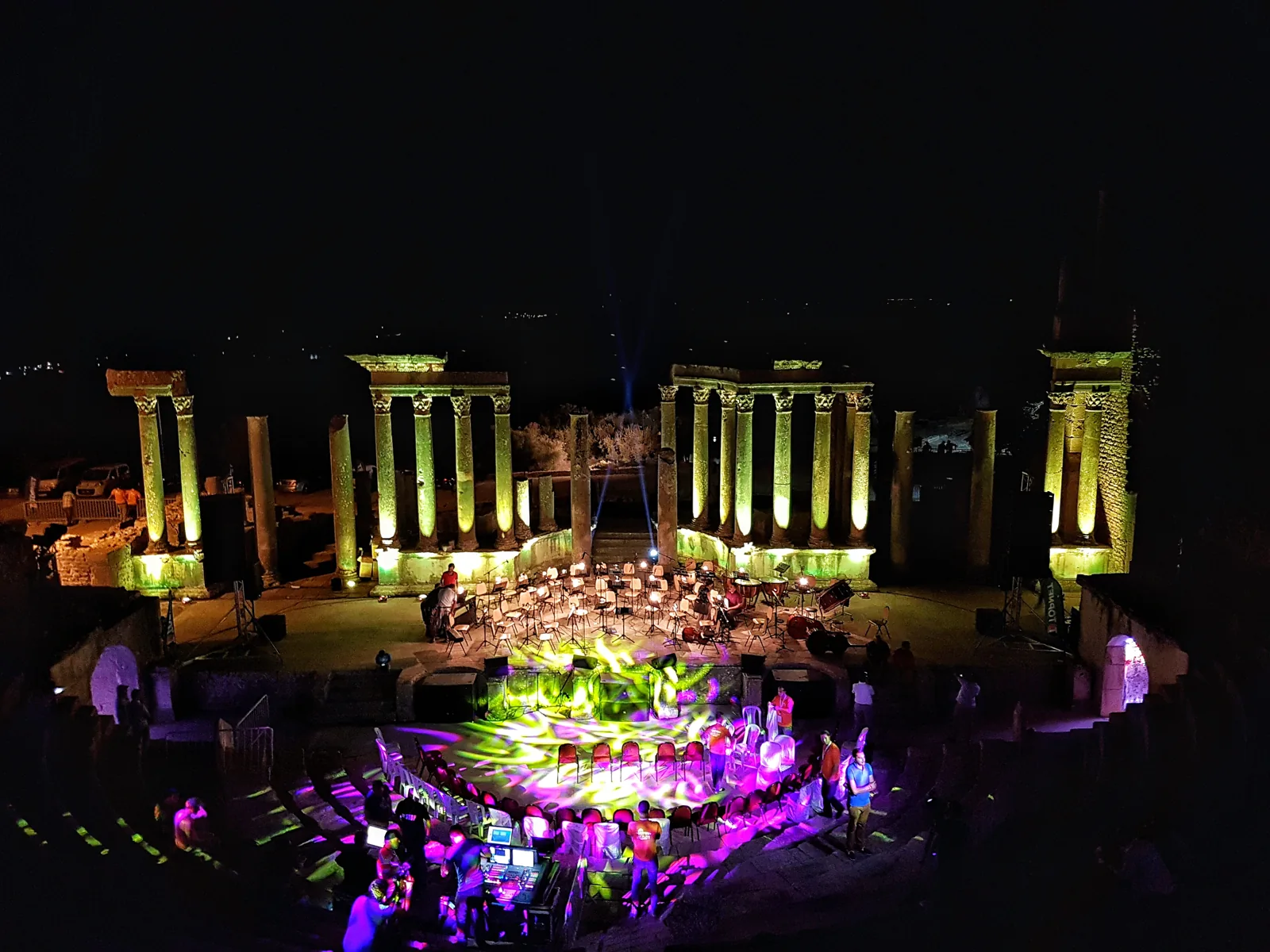
In the next photograph the light changes. Columns are illuminated against darkness; chairs, equipment and people occupy the stage area. This is a record of modern use dated 17 August 2016, not a photograph of an ancient performance. The long life of stone meets the preparations of one evening. Instead of an empty ruin, we encounter a place being used again.
INP dates the ancient theatre to AD 168 or 169 and records Publius Marcius Quadratus as its financial supporter. Its account describes approximately 3,500 seats and a seating area built largely against the rock. These belong to the historical building record, not to the modern equipment visible in the photograph. Image and text give us different kinds of evidence.[2]
Do not look at a theatre only from the stage. Think about entering a row, finding a place and joining a crowd facing the same direction. A benefactor helped create more than a stone structure: he supported a setting in which people could assemble. That offers a starting point for wondering about the relationship between spectators and performance, without inventing a particular ancient evening.
The photograph's date is a key to the story. It prevents modern use from slipping into an account of ancient construction. The image does not establish that the same event continues today, nor does it tell us what the people heard. Our visual reading does something simpler: it asks how the same stones can frame different people at different times.
READING 04
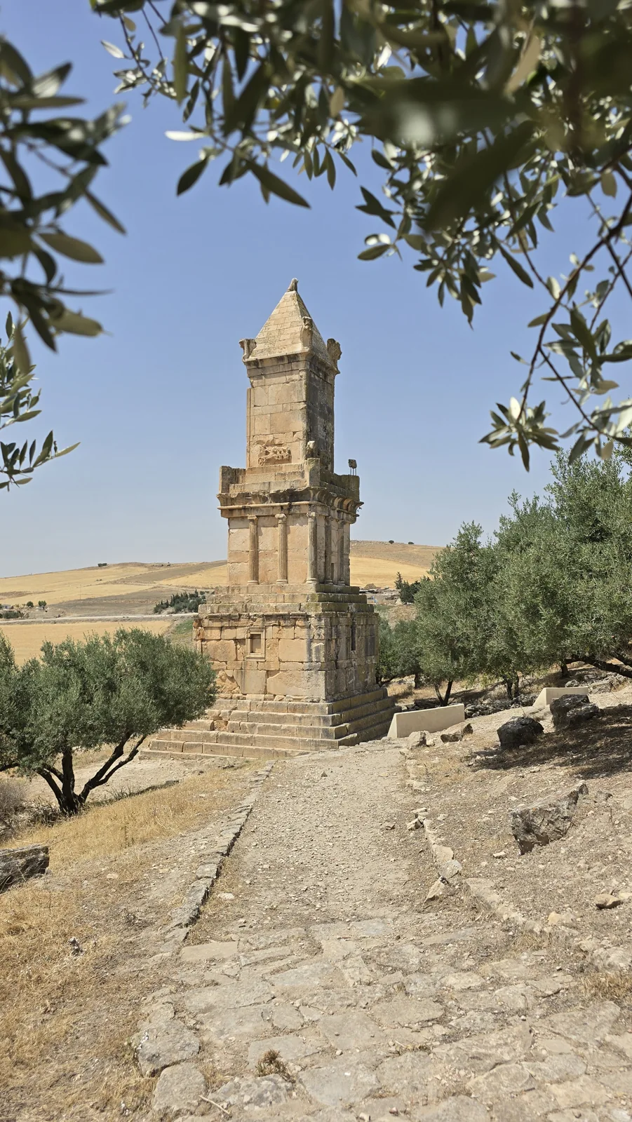
In the final photograph a tall monument rises between olive branches. Follow its stacked forms from the stepped base towards the narrowing summit. The Libyco-Punic mausoleum leads beyond the town's Roman buildings. INP places it in the third to second centuries BCE; UNESCO separately records its reconstruction in 1908–1910 and the resulting discussion of authenticity. Today's appearance has more than one history.[2][1]
Another object extends this story: a bilingual inscription from the mausoleum. Scuola Normale Superiore's Mnamon record presents Libyco-Berber and Punic texts alongside discussion and translation. The translation identifies people working in stone, wood and iron, while leaving some expressions uncertain. Without copying the inscription or its translation, we can follow its invitation to think about the hands that made a monument.[5]
Before a tomb we often ask whom it commemorated. Try a second question: whose work made it possible? Rather than settling its occupant with one confident name, examine how a source supports each identification. Our photograph is not a readable close-up of the inscription. Follow the academic record to study the text; do not treat the distant monument as proof of a particular reading.
Ausonius's publishing account highlights inscriptions as evidence for public and private life and describes the joint Tunisian–French corpus work begun in late 1993. A name, a dedication or a building task can open another door into the city when placed in context. On your discovery card, write down not only the most prominent person but a less visible kind of work you would like to understand.[6]
No boundary follows automatically from a legal distinction. Compare UNESCO's account of coexistence with the research discussion.[1][4]
Its stone setting is ancient, but the equipment and photographed use belong to 17 August 2016. The image is not an ancient performance record.
No. Use the linked Mnamon text record, where materials, scripts, translation and uncertainties are distinguished.[5]
Roman monuments entered an older, largely Numidian urban fabric.[1]
Legal identity alone does not establish spatial segregation. The readable UNESCO account describes one town and territory.[1]
Its 1908–1910 reconstruction is part of the monument's history. Neither its photograph nor a conventional name settles the occupant.[1]
INP's date range for the Libyco-Punic mausoleum.[2]
Construction of the Capitol.[2]
Construction of the theatre.[2]
Municipal status, according to Chronocarto.[3]
Reconstruction of the mausoleum.[1]
World Heritage inscription.[1]
Publication of Khanoussi's presentation and accompanying discussion.[4]
No verified owned Dougga Reel or master film accompanies this story. Open the official UNESCO film page ↗; its films remain with their rights holders.
Open the free Dougga discovery card ↗
This original free English worksheet is separate from paid products; it is not a paid Turkish PDF translation or release.
Urban fabric, legal communities and reconstruction; the 2009 conservation text is not current visitor information.
Official guide published 8 April 2020; construction dates and named benefactors. Historical photographs do not confirm current access.
Project introduction with architectural phases and inscriptions; external WebGIS controls not tested.
Bibliographic page and metadata read this edition; specific p.155 discussion follows the previously checked Turkish production record. Full article not freshly retrieved.
Academic inscription record and translation read; no inscription image or translation copied. Uncertain readings remain uncertain.
Publisher description only, including corpus work from late 1993; not a full-book reading.
Official UNESCO/TBS and NHK source link only; films not copied or embedded. Playback, audio and subtitles not tested.
Original narrative: Geçmişin Haritası. Full English edition: 27 October 2026. The three photographs are dated 2012, 2016 and 2026; none establishes current visitor conditions. Academic and institutional records distinguish legal status, building phases and modern intervention.
Carthage ↗ · Volubilis ↗ · World stories ↗ · Story archive ↗