Find the water
Locate the two basins in the aerial photograph. Describe their outlines before assigning functions.
 GEÇMİŞİN
CARTHAGE / TUNISIA
Two basins, an island, changing shores. Follow the work on land behind a maritime city.
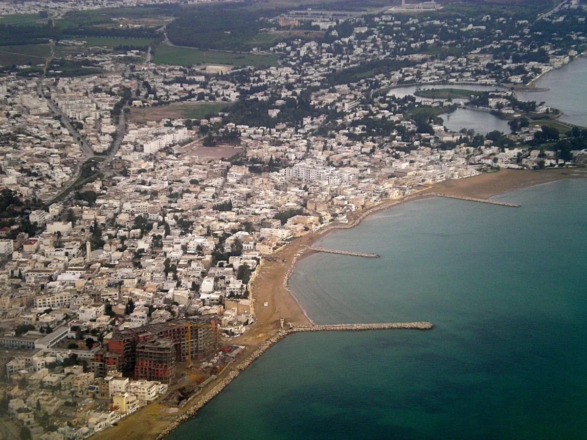
Read Carthage through its harbour shapes, ship-sheds and Byrsa neighbourhood. Separate archaeological phases from Dido’s foundation story, then follow the questions in a research programme announced in October 2026.
Locate the two basins in the aerial photograph. Describe their outlines before assigning functions.
Choose a visible detail beside the modern boats. What excavation record would help establish its phase?
Compare a gap between Byrsa’s walls with Dido’s literary boundary. Which question belongs to each?
READING 01
A harbour’s most powerful image is not always a ship. In the aerial photograph of Carthage, houses and the coastline catch the eye first. Then two pieces of water emerge inland, towards the upper right. One approaches a circle; the other stretches into a longer basin. Their different outlines create a question before we have read a single historical date. Why would one city need two kinds of water space?
Tunisia’s National Heritage Institute links the circular basin to the naval harbour and the elongated one to the commercial harbour described by ancient writers. Its account associates the central island with oversight of fleet movements. It dates the oldest structures identified on the commercial harbour’s western quay to the later third century BCE, and describes the circular military arrangement in the second century BCE.[1]
The distinction turns a quiet waterscape into a problem of organisation. Where could cargo be handled? Where might a vessel wait? Who could approach each space? The photograph does not settle these questions, but it lets us ask them together. A harbour connects a city with the sea; the divisions inside that connection can matter as much as the entrance.
Look inland from the coastline again. Modern settlement surrounds the surviving basins. This is not a complete plan of ancient Carthage laid out for inspection. It is a dated view in which parts of a much longer history remain legible. Begin with the shapes you can describe, then ask what kind of evidence could turn an outline into an explanation.
READING 02
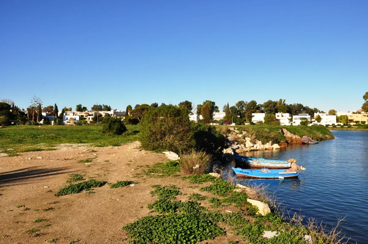
The second photograph brings us down to the shore. Blue boats, vegetation, stones and houses occupy a scene with little suggestion of a fleet preparing to depart. The boats are modern. Yet the view offers a useful change of scale: a vessel needs more than open water. Its life also depends on places ashore where people can prepare, shelter and maintain it.
Henry Hurst’s summary of the 1975 excavation season reports a major change in the island’s topography in the fourth century BCE, followed apparently by timber and then stone ship-sheds. It also discusses Roman quays and evidence concerning the link between island and mainland. These are successive phases, not the description of a harbour built once and left unchanged.[2]
Imagine approaching a stone at the water’s edge with a notebook rather than a ready-made label. What connects it with the surface beside it? Which deposits help establish its date? A photograph may preserve colour, position and an appealing view, while an excavation record preserves relationships below that view. Neither record performs the other’s task.
That is the hidden workshop in our title: not an invented reconstruction of workers at a particular hour, but a way of directing attention towards preparation on land. Before looking for the departing ship, ask about the place that held it. Before naming a period, ask how the sequence was established.
READING 03
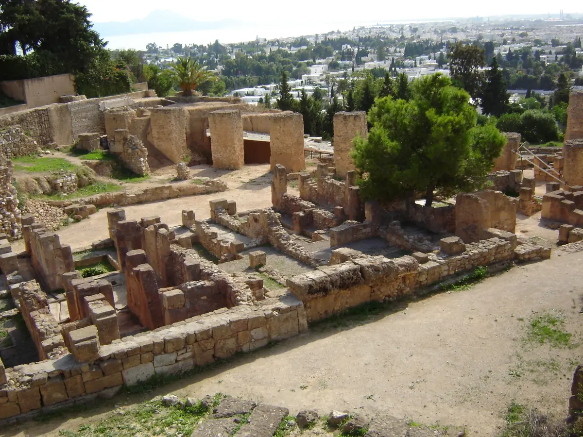
Carthage becomes smaller than itself if we look only at its harbours. In the photograph of the Punic quarter on Byrsa, low walls, open gaps and higher masonry draw the eye into the city. We readily turn those lines into rooms and streets. Even without complete buildings, their relationships make us think about the difference between an interior and a route past it.
Byrsa also belongs to a different kind of line: Dido’s boundary in a foundation story. In book one of Virgil’s Aeneid, her followers acquire as much land as they can enclose with an oxhide. Dickinson College’s commentary explains the story of cutting the hide into narrow strips. This is literary tradition, not an excavated contract proving a particular purchase.[3]
The attraction of the story lies in a small surface becoming a long boundary. The walls of an archaeological neighbourhood invite another kind of reading, through material and context. Putting the two together need not make either one proof of the other. A city’s life in literature and its investigated past can answer different questions.
Punic Carthage was destroyed by Rome in 146 BCE; a Roman city subsequently developed on the site. UNESCO presents an archaeological landscape shaped by successive cultures.[4] Rather than assigning every surviving wall to one final scene, ask where each fragment belongs. A ruin can mark an ending while the place continues into other histories.
READING 04
A historical story can give the impression that research has reached its last page. Carthage offers a reminder that the record remains open. On 21 October 2026, the National Heritage Institute announced a Tunisian–Chinese project launched on 15 October, with work planned through 8 January 2027. Excavation, archaeological study, topographic survey using modern techniques and cataloguing form parts of the announced programme.[5]
A programme is not a finding. Its interest lies partly in the different kinds of work it brings together. Survey provides a common spatial framework for observations. An inventory allows an object to be found again within a system of records. Both can make later comparisons possible without already determining their results.
Our photographs belong to three other moments: the aerial view to 2007, the shore to 2017 and Byrsa to 2004. None documents the 2026 mission. Keeping the dates visible helps us avoid folding an old image, a recent announcement and an ancient construction into one apparently continuous scene.
Find the two basins once more. At the beginning they may have been little more than shapes. Now they open towards questions about commerce, fleets, work, neighbourhoods, stories and survey notebooks. The pleasure is not in finishing the whole city at once. It is in returning to the same view with a more precise question.
INP associates the circular basin with the naval harbour and the elongated basin with commercial use. Shape provides a starting observation; archaeology and ancient texts support the functional reading.[1]
Hurst’s open summary discusses ship-sheds and Roman quays within a sequence. Do not make every stone in a modern shore photograph part of one construction event.[2]
The oxhide episode belongs to a literary narrative. Dating a wall requires its archaeological context. The story can instead be investigated as evidence for how a city was imagined.[3]
Dido’s oxhide boundary is a foundation narrative, not an archaeologically verified land transaction.[3]
The 2007 aerial image includes modern settlement. It is neither a full ancient reconstruction nor a photograph of the 2026 mission.
The October 2026 notice sets out planned work. This story does not claim unpublished finds or completed conservation outcomes.[5]
UNESCO’s foundation period for Carthage.[4]
Major topographic change on the island reported in the summary of the 1975 excavations.[2]
INP’s dating of the oldest structures found on the commercial harbour’s western quay.[1]
INP’s period for the described circular military harbour.[1]
Rome destroys Punic Carthage; Roman Carthage develops later.[4]
Excavation season / publication of Hurst’s second interim report. Its online publication in 2011 is a separate date.[2]
Inscription on the World Heritage List.[4]
Project launch / institutional announcement. The announced end date is 8 January 2027, not a completed result.[5]
No verified Geçmişin Haritası Carthage Reel or master film accompanies this story. Visit the official UNESCO / NHK video page ↗. Its film remains with the rights holder; it has not been copied or embedded here.
Read the dated INP project announcement ↗ and distinguish an announced task from a result.
Describe the water, ask about a working area, separate Dido’s narrative from material context and record a question for future research.
Open the free Carthage discovery card ↗Original free English worksheet; not a translation or release of a paid Turkish PDF.
Harbour section and its archaeological phases; not a review of the complete bibliography.
Open summary and metadata only. Print 1976, online 2011; the full access-restricted article was not read.
Especially lines 365–368 and the commentary on 367: literary tradition, not an excavated transaction.
The short French description confirms 146 BCE; contradictory CE wording elsewhere is not adopted.
Launch 15 October 2026, announcement 21 October 2026, planned end 8 January 2027. A programme is not a completed result.
Source link only; no film copied or embedded, and external playback/audio/subtitles not tested.
Original narrative: Geçmişin Haritası. English edition: 26 October 2026. Institutional records, open excavation summary and the three image records checked. The photographs are dated 2004, 2007 and 2017; they do not depict the 2026 mission or establish present visitor conditions. No institutional partnership or endorsement is claimed.