
Summary
Begin with the stepped tank, follow the water channel, and look beneath the bazaar street. Three dated photographs and institutional records connect visible forms with the work of supply, investigation and conservation.
Three ways into the city
- Tank: Where the water arrives · 2014 / geometry
- Channel: Follow the connection · 2007 / stone line
- Bazaar: The story of the ground · 2024 / street
The question asked by the steps
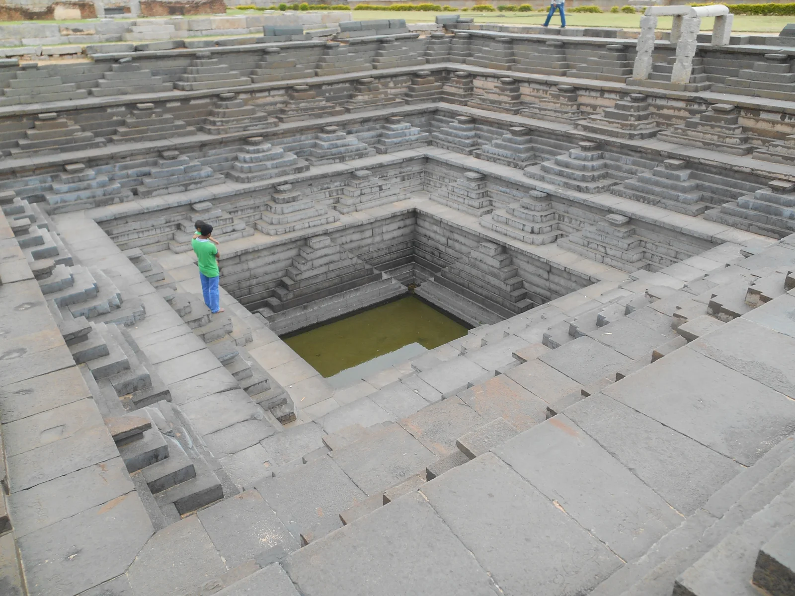
The lines in the photograph draw your eye downwards. Corners within corners, narrowing squares and a little water at the bottom: it is easy to be captivated by the symmetry. Lift your gaze from the steps for a moment, however. How did the water get here? Behind a beautiful tank may lie an urban arrangement too large for one frame. We enter Hampi this time through a question opening towards the ground, rather than through a lofty temple tower.
Hampi lies in the Tungabhadra basin in Karnataka, India. Much of its surviving fabric belongs to the city that served as the Vijayanagara Empire’s capital between the fourteenth and sixteenth centuries. UNESCO describes temples, bazaars, residential areas and water structures within an interconnected setting. Treating the rocky landscape and human arrangements as two separate scenes would weaken those connections. [1]
The easiest feature to pick out in a city photograph is often the tallest building. Yet the arrangements sustaining life sometimes pass lower down: beside a channel, at a storage place, across a surface worn by use. That is why the tank’s geometry invites another story. Think now about the possible route of the water rather than the water at the image’s centre. The next photograph gives that question a form extending across stone.
Carry the water, then distribute it
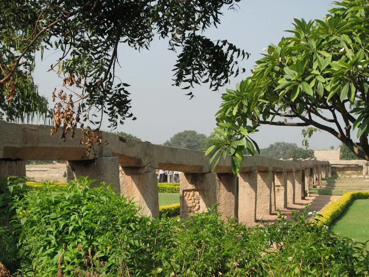
There is no single grand monument in the channel photograph. A horizontal line runs along a succession of supports, partly screened by branches. In this side view recorded in 2007, first distinguish what carries from what is carried. Counting supports is a start. A more interesting question concerns the line’s connection with the next structure. Water architecture reveals relationships between places as well as the form of an object.
ASI’s Royal Enclosure account places the stone channel within a wider arrangement distributing water to tanks at different levels. The middle branch leads to the stepped tank, the eastern branch to the large tank; at the western end, two conduits divide into smaller channels. The order of distribution matters alongside the presence of water. Learning where a branch goes changes the tank from an isolated shape into part of a network. [2]
Select the three stops at the water-reading desk below. They are reading stops separating relationships described by the institution, not a scale map or working hydraulic simulation. Consider the main line first, then the branching connection and finally the receiving tank. Set what you can see directly in the photograph beside what you learn from the source, and a small line in the landscape becomes a larger question about the city.
One waterway, several stops
Select each heading to follow another relationship in the Royal Enclosure’s distribution network.
Relationships from source 2; not a scale plan, visitor route or flow simulation. Change radio choices with the keyboard arrow keys.
Reading the bazaar beneath the stone
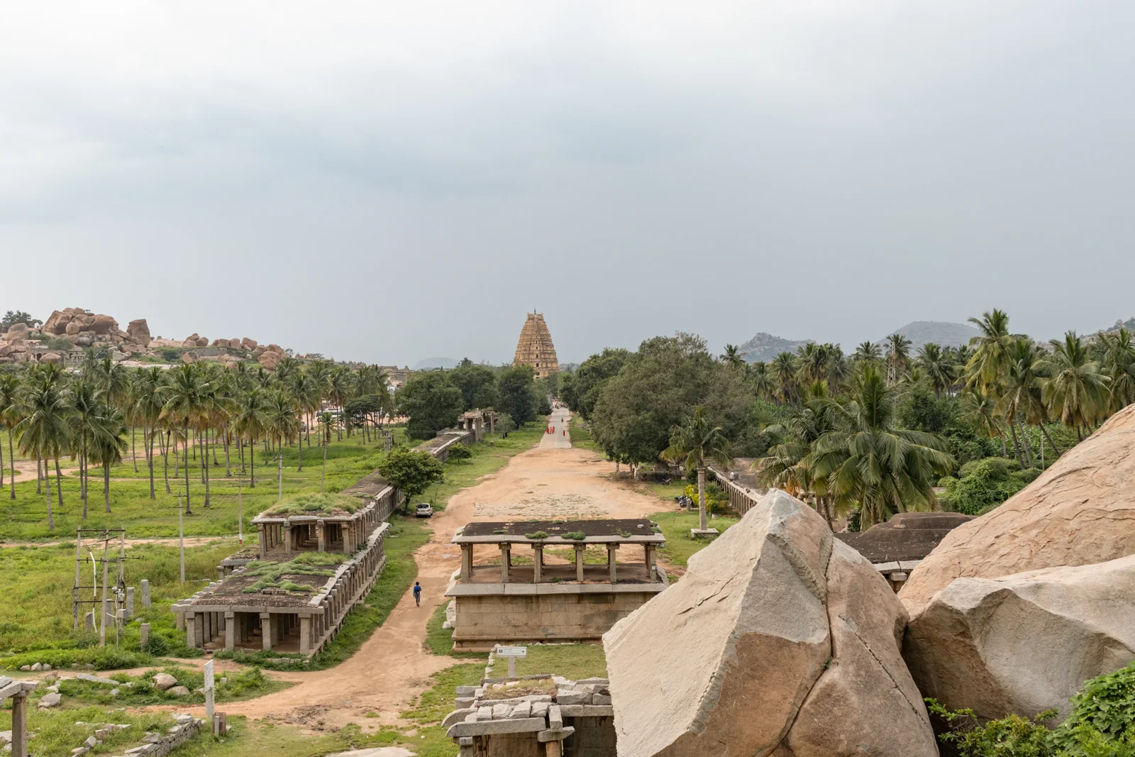
In the Virupaksha bazaar photograph, follow the long street towards the distant tower. Repeated columned structures frame its sides. The view may invite you to imagine a crowd no longer present in the picture. Rather than filling the story entirely with imagined stalls, look beneath your feet. Understanding a bazaar’s past sometimes means following a walked surface instead of its most impressive stone.
Karnataka’s official tourism account describes a trading street lined with columned structures. ASI’s 2024 conservation report goes below that general view. Paving known from other bazaars prompted a search for a comparable surface around Virupaksha. A trial pit in the southern bazaar revealed paving about 89 centimetres below the surface; comparison associated it with the Vijayanagara period. [4][5]
Here the route into the past begins with a hypothesis and continues through investigation. Nearby examples suggest what to seek and where; an opening in the ground tests that expectation. Yet the finding does not automatically name a seller, tell us what was sold on a particular day, or reveal the entire street’s appearance at one moment. The bazaar’s story becomes richer when a broad image is joined by an account of how one specific question was investigated.
Life beyond the word ruin
Freeze Hampi at one moment of destruction and you miss the different lives of water, bazaar and temple. The Battle of Talikota in 1565 brought major destruction to the city’s physical fabric. Yet UNESCO emphasises continuing worship at Virupaksha and the survival of rituals, pilgrimage and agricultural traditions. A capital’s political rupture and the simultaneous end of all life are different things. [1][7]
Nor does the temple fit into a single moment of construction. ASI describes additions and arrangements dating to around 1510 under Krishnadevaraya. Avoid assigning everything visible in a tower to one founder on one day, and a long history of use becomes easier to recognise. Continuity in stone does not mean an absence of change. [3]
Conservation belongs within this life. ASI’s 2024 report describes rain and accumulated water complicating documentation, alongside the particular conditions of working where worship continues. UNESCO’s 2017 decision likewise considers bazaar conservation together with circulation and site management. These dated records show why conservation must also be read through time; they are not a report that every activity remains in the same condition today. [4][6]
Return to the opening tank. You now see more than squares within squares. You ask about the supplying channel, its branches, nearby urban life and the people working to understand this past. This way of looking may be one of Hampi’s best souvenirs: after appreciating a structure’s beauty, seek the trace connecting it to another place and another task.
Build a question from three details
What can the tank alone not tell us?
Geometry is visible in the photograph. Seek the supplying branch’s position within the network in ASI’s account. [2]
How was the bazaar surface tested?
Follow hypothesis, trial excavation and comparison on printed page 21 of the 2024 ASI report, PDF page 182. [4]
From a capital to living heritage
- Fourteenth–sixteenth centuries
The Vijayanagara capital gives rise to much of the surviving urban fabric. [1]
- Around 1510
Additions to the Virupaksha complex under Krishnadevaraya. [3]
- 1565
The Battle of Talikota and major destruction of the city’s fabric. [1]
- 1986
The Group of Monuments at Hampi enters the World Heritage List. [1]
- 2017
The World Heritage Committee considers bazaar conservation and circulation together. [6]
- 2024
ASI’s Virupaksha Bazaar conservation strategy records the paving investigation and documentation conditions. [4]
Evidence, legend and interpretation
Tradition and legend
ASI’s introduction traditionally associates Hampi with Kishkindha in the Ramayana. That association does not mean photographs archaeologically prove the epic’s events. [8]
Documented traces
Stone channels, tank connections and the paving investigation are different material records. The value of a cultural narrative and the limits of an excavation finding are separate questions. [2][4]
Our reading of the place
Moving from tank to bazaar is our editorial way of reading the city’s connections, not a reconstruction of one historical day.
From the image to the research record
No video accompanies this page. Open the three dated photographs at full size or follow the original page of the bazaar investigation.
ASI report: Paving investigation ↗ · UNESCO: Monuments and conservation ↗
Draw a connection in your own words
Use the free card to explore the water route, the bazaar’s evidence and a question about living heritage. Keep observations separate from source information.
Open the free Hampi discovery card ↗ · Existing illustrated discovery collections ↗
A return path for every connection
- UNESCO · Group of Monuments at Hampi
- ASI Hampi Circle · Royal Enclosure area
- ASI Hampi Circle · Virupaksha Temple Complex
- ASI · Conservation Strategy for Virupaksha Bazaar · 2024, printed 21–23 / PDF 182–184
- Karnataka Tourism · Hampi Bazaar and Royal Enclosure
- World Heritage Committee · Decision 41 COM 7B.90 · 2017
- UNESCO · Technical assistance for Hampi conservation
- ASI Hampi Circle · Introduction and traditional associations
Complete English edition of the current four-chapter Turkish story and its four-field free card. Source review: 25 October 2026. ASI web records were available as indexed institutional text; the cited 2024 report pages concern a dated investigation, not current site conditions. Photographs date from 2007, 2014 and 2024. Original narrative: Geçmişin Haritası. No institutional partnership or endorsement is claimed.
Other cities of water
Petra: A city shaped by water ↗ · Angkor: Water, labour and seasons ↗
Continue the seven-city water route ↗