
One city. Two waterways. Three kinds of evidence.
Can a photograph, a field record and a calculation take one another’s place? Use this free evidence notebook to test the verbs in your own account.
Return to the story ↗ · Four-field discovery card ↗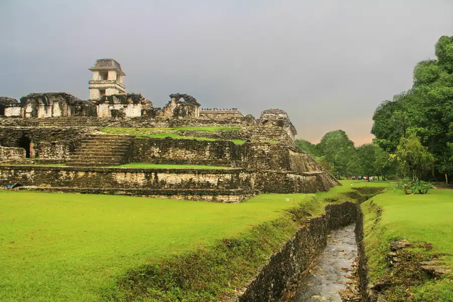
Begin with the name. A photograph of a watercourse beside the Palace, a survey of a covered stretch and a model of a different conduit cannot simply be combined into one description. Their relationship must be established, not assumed. Write what you can see before adding what a record tells you.
Then look at your verbs. “Visible”, “recorded”, “calculated” and “proposed” do different work. Replacing all four with “proved” can turn an interesting question into a claim that no single source makes. A short sentence for each step often keeps the investigation clearer.
A date also needs a subject. The years 1999 and 2006 belong to the research history described by Penn State. They do not date construction. Put the object, the event and the source in separate columns before writing a timeline. [5]
Decide, then open the answer
“The conduit was built in 1999.”
This changes a research date into a construction date. In the institutional account, 1999 is when the feature was identified during a survey. [5]
“The photograph shows an open channel beside the Palace.”
An observation tied to an identified photograph. It does not reveal every covered section or its ancient operating conditions.
Notes are not saved. Print or save as PDF before closing. Original free exercise, not a paid-file translation.
Source desk
- UNESCO — Pre-Hispanic City and National Park of Palenque
Official overview and inscription record read. Brief source summaries differ on the high-point interval; no exact founding date asserted.
- INAH — Palenque site and structure guide
History and aqueduct sections read directly; building uses and landscape context. No current ticket or access advice reproduced.
- Kirk D. French — The Waters of Lakam Ha (2001)
Selected introduction, definitions and Otulum passages read in the 44-page PDF, including printed pages 17–18 on OT-C1/OT-A1 and 58.5 metres. Not all pages or maps reviewed.
- French and Duffy — Prehispanic water pressure (2010)
Institutional abstract and metadata read directly: Journal of Archaeological Science 37(5),1027–1032, May2010, DOI10.1016/j.jas.2009.12.003. Full six-page paper not read.
- Penn State — Maya plumbing research account
Direct institutional account, last updated8February2011: research dates, urban space and possible uses. No complete final fountain arrangement established.
- French, Duffy and Bhatt — The hydroarchaeological method (2012)
Institutional abstract and metadata read directly: Latin American Antiquity23(1),29–50, March2012, DOI10.7183/1045-6635.23.1.29. Full paper/model data not inspected.
- Edwin L. Barnhart — Palenque Mapping Project, 1998–2000
Presentation introduction and methods summary read: building corners, stream edges and topography. Full map suite not downloaded or reproduced.
- INAH — Lakamha’, place of great waters
Official written account read directly: ancient name, farming, fishing and crafts. Linked audio not played.