See the connections
Move from a single temple to the wider panorama. Ask what the trees conceal and what a mapped settlement can reveal.
 GEÇMİŞİN
TIKAL / GUATEMALA
From stone above the canopy to mineral grains beneath the ground: discover the less visible life of a Maya city.
4 readings · 3 licensed photographs · 8 source records
Look beyond the monuments ↓ · Free discovery card ↗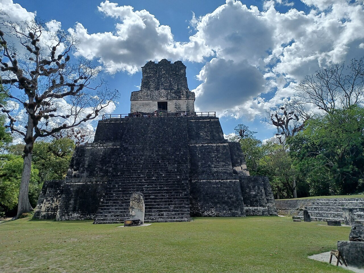
Tikal becomes a different city when we look beyond its tallest buildings. A panorama raises questions about connections, reservoir minerals suggest practical knowledge, and plant DNA opens a window onto former shorelines. Read the monuments alongside the daily problem of sustaining a city, while keeping the histories of ancient centres distinct from the lives of Maya people today.
Move from a single temple to the wider panorama. Ask what the trees conceal and what a mapped settlement can reveal.
Separate storing enough water from maintaining its quality. A mineral grain can become evidence when its context is known.
A modern photograph and DNA in reservoir sediment record different things. Neither is a complete image of an ancient day.
READING 01
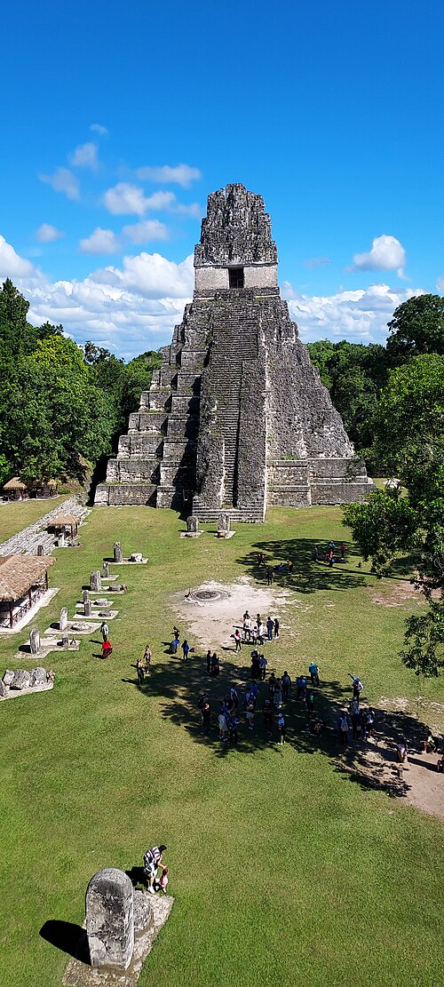
A temple appears above the forest. For an instant, the whole city seems to fit inside that narrow silhouette. Then the eye moves across the green surface: another roof, another rise, another patch of distance. Is the space between them really empty? Tikal’s most productive invitation may begin there, between the buildings we immediately notice. Let the panorama interrupt the habit of collecting one impressive monument after another.
Tikal lies in northern Guatemala’s Petén region. UNESCO describes a landscape of temples and palaces, but also squares, residences, roads and reservoirs. Its World Heritage inscription recognises both cultural and natural values. The forest and the remains belong within the same protected landscape, rather than serving as decoration for each other. [1]
Writing for Penn Museum, Marshall Joseph Becker explains why the map made by Robert Carr and James Hazard mattered. It helped demonstrate the urban character of a settlement obscured by dense vegetation. Systematic mapping and work across different groups of structures changed the question from where the biggest temples stood to how a city was arranged. [2]
Open the full panorama and follow its horizon slowly. A temple viewed alone is a destination; viewed among other places, it becomes part of a relationship. Where might people approach, pass between spaces or carry out ordinary work? The photograph begins those questions without finishing them. A view taken on 8 October 2010 is a record of that view, not a plan of every ancient household beneath the canopy.

READING 02
A temple’s height announces itself. The water needed to get through a day does not make the same entrance. When rainfall and the moment of use are separated, storage becomes more than filling a vessel. Imagine enlarging that vessel to the scale of a city. Its edges, its catchment and the material carried into it suddenly matter. Keeping water available and keeping it usable become two different tasks.
The University of Cincinnati’s account of the research describes seasonal drought and porous limestone as challenges to water access. At Corriental reservoir, researchers identified quartz and zeolite in sediments. The 2020 study interprets these findings as evidence for a filtration system. The argument concerns material in context, not a complete treatment plant found intact and ready to operate. [7], [3]
The striking change of scale is from a handful of grains to a city’s history. Researchers ask what the minerals are, where comparable material occurs and how their presence fits the reservoir. These questions make the explanation testable. A photograph of a temple cannot substitute for that chain of reasoning; nor can the general appearance of water establish its quality. [3], [7]
Try changing the question you would ask beside a reservoir. Instead of only how much it holds, ask what must be known to keep its contents usable. Choosing material, watching flow and noticing accumulation become matters of practical intelligence. This is a thinking exercise, not a claim to recover a particular worker’s instructions. It helps us look for knowledge in small traces as well as monumental engineering.
READING 03
Imagine looking for shade beside stored water while nearby steps remain in sunlight. That scene is an invitation to think, not a documented afternoon in ancient Tikal. It leads to a question that can be researched: which plants grew around the reservoirs, and how could we know? A tree visible in a photograph is immediate evidence of a photographed landscape. Earlier vegetation requires a different archive.
The environmental DNA study published in June 2021 examined plant traces recovered from reservoir sediments. It found evidence that the investigated ancient banks were mainly fringed with native tropical forest vegetation during Maya occupation. Its samples address particular places and periods. They do not show that each tree visible today stood in exactly the same position centuries ago. [4]
This approach widens the idea of a historical record. Writing on stone is not the only trace that can answer a question about a city. Sediment can preserve material that researchers analyse to investigate a former environment. The visible green surface and the laboratory result are complementary kinds of evidence, with different limits. One should not be turned into an illustration proving every detail of the other.
Look back at the panorama after reading the study’s question. Stone and forest need not be opposing characters, one authentic and the other an obstacle. Nor is a cleared research area identical to a landscape used by past inhabitants. Our attention can move from the temple’s upper outline to the shoreline, and from the shoreline to the ground. The city becomes more interesting when we allow its less obvious records into the story.
READING 04
It is tempting to give a great city one final scene: a door closes, trees advance and everyone disappears. Such an ending is easy to remember, but it can make historical change deceptively simple. A centre losing population or political importance is not the same event as a people ceasing to exist. Before accepting the final scene, ask what evidence it leaves out.
A separate 2020 study of sediments from four Tikal reservoirs reported high mercury, phosphate and traces of potentially toxin-producing cyanobacteria in two major reservoirs. Water quality therefore belongs among the questions about the city’s difficulties. These findings do not establish one sufficient cause for its entire transformation, or an identical history for every reservoir. [5]
Smithsonian’s Living Maya Time teaching resources connect ancient knowledge with Maya people living in the present. That perspective matters when reading an archaeological centre. We can study buildings and environmental pressures without narrating living cultures into silence. The end of one urban story does not provide an ending for all the people whose histories extend beyond it. [6]
Return once more to the panorama. The temples remain impressive, but their surroundings no longer need to be a lost background. Think of routes, stored water, traces of plants and the research questions that connect them. Tikal leaves us more than the question of how a building reached such a height. It also asks something less spectacular and more human: how was a city sustained, again and again, through ordinary days?
Three ways to separate a visible detail from its interpretation. This is a reading guide, not a reconstructed reservoir plan or a simulation of an ancient day.
Visible: A dated panorama shows structures rising above a forest canopy.
Interpreted: Mapping helps investigate settlement relationships that the photograph cannot reveal on its own.
Source 2 ↗Visible: These temple photographs do not show the quartz or zeolite samples.
Interpreted: Analysis of Corriental sediments supports an archaeological explanation of filtration, not a claim about every Maya reservoir.
Source 3 ↗Visible: The photographs show vegetation on their stated dates.
Interpreted: Environmental DNA addresses sampled past vegetation; it is not a label for every present tree.
Source 4 ↗A photo does not locate every residence or route. Compare what is visible with the different task of systematic mapping. [2]
No. The water-quality argument comes from sediment research, not the appearance of these architectural photographs. [3], [5]
No. Read the histories of individual centres alongside resources about Maya people and cultural knowledge in the present. [6]
Plans, structures, mineral analyses and environmental DNA answer different questions. An attractive image does not replace their contexts. [2], [3], [4]
The filtration explanation concerns Corriental evidence. It is not proof that every reservoir or Maya city used the same arrangement. [3]
Contamination findings make water quality relevant. They do not alone explain the entire history of urban change. [5]
The canopy does not establish that the intervals between monuments were uninhabited. Mapping is needed to investigate the wider city. [2]
The research reconstructs a practice from sediments and materials. The supplied photographs show temples and a panorama, not an operating ancient filter. [3], [7]
That phrase confuses transformation at an ancient centre with the continuing lives of Maya people. It is not the historical explanation used here. [6]
Beginning of the broad habitation range in UNESCO’s introductory description. [1]
Classic-period frame used in the environmental DNA study’s abstract; not the limits of all settlement at Tikal. [4]
Carr and Hazard’s plan appears in Tikal Report 11, as documented by Penn Museum. [2]
Tikal National Park enters the World Heritage List under cultural and natural criteria. [1]
Separate papers publish reservoir-contamination findings and Corriental filtration evidence; the filtration paper appeared on 22 October. [3], [5]
Publication of the environmental DNA study of reservoir vegetation. [4]
No verified Geçmişin Haritası film or Reel is available for this story. The official UNESCO/NHK film is linked at its source; it has not been copied or embedded here, and playback has not been verified.
UNESCO / NHK: official film page ↗Open the free English discovery card ↗
An original reading exercise. It neither translates nor releases any paid Turkish PDF.
Urban and natural landscape, broad habitation range and 1979 World Heritage inscription; not a present visitor-condition report.
Institutional essay read directly: mapping by Carr and Hazard, settlement groups and 1961 plan publication.
Direct page blocked by publisher cookie redirect. Publisher-indexed abstract and metadata read, corroborated by the university authors’ institutional report. Full paper not read this run.
Abstract and introduction read on first direct access; follow-up access encountered cookie redirect. Sampled reservoir-bank vegetation, not the identity of every current tree. Full paper not read this run.
Direct page blocked by publisher cookie redirect. Publisher-indexed abstract read: four reservoirs, two major contaminated reservoirs. Full paper not read this run.
Official guide read directly; connects Maya knowledge and people in the present. Original maya-peopleURL returned 520, so this reachable institutional guide is used instead. No external activity/video testing.
Institutional research report read directly. Quartz,zeolite,sediment analysis and seasonal water-access context. Author interpretation is not an intact operating filter.
Official UNESCO/NHK film page, all rights reserved. Link only; no copying,embedding or playback/audio/subtitle QA.
Original narrative and English edition: Geçmişin Haritası. Sources checked 29 October 2026. Photographs date from 2010, 2022 and 2025; they do not establish current visitor conditions. The panorama uses the existing 3000 × 384 public derivative. Source-access limits are stated with each record. Image licences are separate from rights in this original narrative.