Riverbank
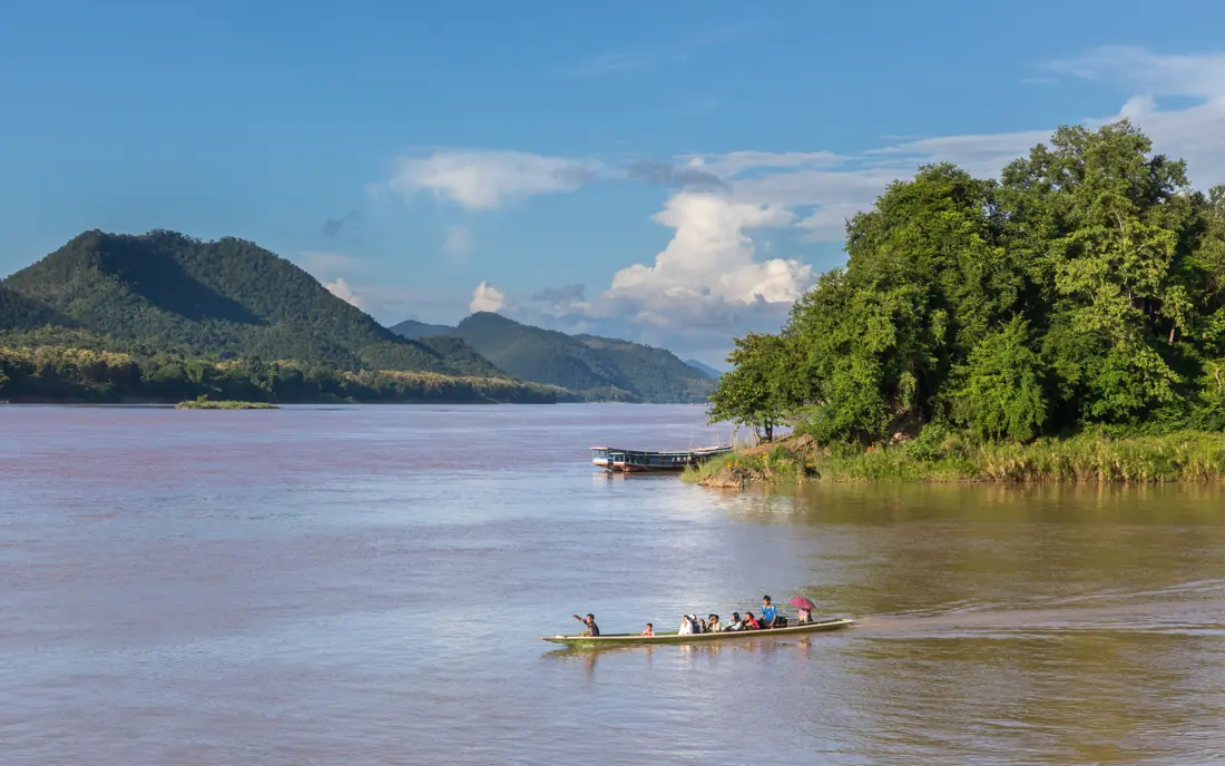
Identify the boat's wake, the bank and the hills. UNESCO explains the peninsula; this photograph is not a river survey. [1]
 GEÇMİŞİN
LUANG PRABANG / LAOS
Follow a boat towards the Mekong, a temple roof towards the ground, and a wooden threshold towards the people who keep knowledge alive. First see the buildings; then look for life.
4 chapters · 3 dated photographs · 9 sources
Between the Mekong and Nam Khan, Luang Prabang brings religious buildings, timber houses and colonial architecture into one townscape. Three dated photographs invite two readings: describe a visible detail, then investigate its use and the people connected with it.
READING 01
A narrow boat draws a line across a broad surface of water. Beyond it are hills; to the right, a green bank. The cover photograph, taken in September 2023, records a passage from the Nam Khan towards the Mekong. We do not need to begin with a palace. Compare the boat with the hills behind it. The human scale of the landscape changes as your eye moves between them.
Luang Prabang occupies a peninsula between the Mekong and Nam Khan in northern Laos. UNESCO places its period as the capital of Lan Xang between the fourteenth and sixteenth centuries. [1] The rivers suggest approaches, landing places and boundaries. A photograph offers a moment within that longer geography: it cannot supply a present-day measurement of current, depth or water quality.
The 1995 ICOMOS evaluation describes a town that grew from older village communities around royal and religious places. Its history also records the French protectorate established in 1893 and subsequent changes in the urban fabric. [2] Imagine looking from one roof to the next. Their closeness may bring together different beginnings rather than one original plan. Reading the town means allowing those different times to remain visible.
READING 02
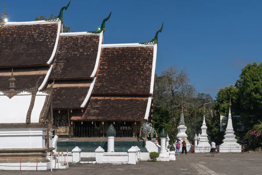
Follow the roof edge in the second photograph. Find an upturned end, then the broad tiled slope spreading downwards. Another tier repeats the movement at a different height. Before naming every ornament, let your eye travel along those lines. The building invites movement even when you are standing still. The courtyard and smaller structures around it help keep the main hall in proportion.
The local tourism authority associates the foundation of Wat Xieng Thong with King Setthathirath around 1560. Its account highlights the low, layered roof. [3] That foundation date and the photograph's date, 4 November 2024, answer different questions. The image does not demonstrate that every visible component survives unchanged from the sixteenth century.
This is the sim, the principal hall within a wider wat. Northern Illinois University's architectural guide distinguishes that hall from residential and meeting spaces in a monastic compound. [4] Recognising the difference restores some of the everyday organisation around a celebrated monument. Ask what makes this roof special, then ask how the building relates to the places where people gather and live. We will carry the same question to a much smaller wooden threshold.
READING 03
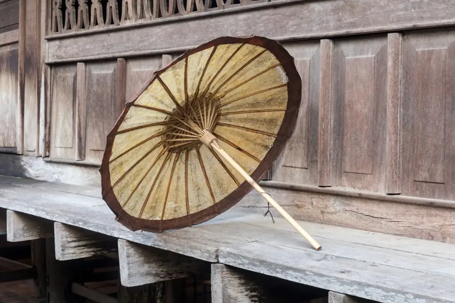
An open umbrella rests against a wooden house. Its thin ribs and the heavier beams beneath the floor share the frame. One makes the other seem more substantial. This photograph, taken at Heuan Chan Heritage House on 13 September 2023, brings the story from a monumental roof towards the scale of a hand. Look for the meeting of separate pieces, not only the colour of the finished surface.
The city's official tourism page describes Heuan Chan as a cultural information centre in a historic timber building, with interpretation of textiles, belief, family life and cultural diversity. [8] The house therefore offers two readings: a material structure, and a place where knowledge is communicated. This arranged detail is neither a complete floor plan nor a picture of how every Lao family has always lived.
The university guide connects raised floors with work and storage below, and projecting eaves with shelter from seasonal rain. [4] ICOMOS also describes timber and masonry in combination within the town. [2] Such relationships encourage us to notice adaptation. Preserving a house need not mean forcing every part into one imagined pure style. A threshold can lead towards questions about both construction and changing use.
READING 04
How does skill remain in a city? Is displaying an object enough, or must there also be room for people to practise and pass on their knowledge? Founded in 2006, the Traditional Arts and Ethnology Centre links museum work with artisan communities, education and research. Its own account emphasises the distinct cultures and livelihoods of Laos' peoples. [5] That approach resists turning many communities into one anonymous tradition.
A related question runs through the wider town. AFD's institutional interview page, published on 1 May 2018, frames conservation as a balance between tourism's employment and income and residents' living conditions. [7] It identifies a problem to keep thinking about, rather than proving that the balance has since been achieved. The accompanying film is an external source; its complete playback and audio have not been tested here.
UNESCO's account of cooperation over 1995–2015 traces the programme established in 1996 through local training, infrastructure and wetland restoration as well as buildings. [6] The site description includes ponds used for fish farming and vegetable growing. [1] Water between buildings belongs in the story too. Follow the two waterways in the site description, then consider the smaller spaces of water inside the town; they operate at different scales.
Return to the boat. Finding the people in a large landscape takes a slower look. A roofline and a craftsperson's knowledge, the timber of a house and its later role as a learning place: each adds something to the other. On our first reading, we found structures. On the second, we began to look for the life that needs to continue within and around them.
Find a detail first; then connect it to its source.
Identify the boat's wake, the bank and the hills. UNESCO explains the peninsula; this photograph is not a river survey. [1]
Trace the tiers of the sim. Then distinguish this hall from the larger monastic compound. [3], [4]
Compare the umbrella ribs with the floor beams. Heuan Chan's present interpretive role comes from the institutional description, not from the photograph alone. [8]
Describe one visible material and the way separate parts meet. Keep observation in your own words.
Ask who uses the place and what knowledge it communicates. Compare Heuan Chan's interpretation with TAEC's community work. [8], [5]
Distinguish the peninsula's two rivers from the town's ponds and wetlands. Use the source to connect landscape with everyday activity. [1], [6]
The visible passage helps introduce the peninsula. It does not reveal the complete street network. [1]
The photographed sim is a hall within a larger compound, not the whole monastery. [4]
It records a threshold at Heuan Chan in 2023. Consult the institutional account for the building's interpretive role. [8]
SEAsite recounts a local foundation tradition involving a remarkable tree and guardian nagas. This is meaningful cultural memory, not a dated eyewitness record of the events. [9]
Around 1560 relates to the temple's foundation. The 2024 photograph does not date every visible part. [3]
UNESCO's cooperation account treats conservation as managing change with inhabitants, rather than inventing an allegedly original appearance. [6]
ICOMOS links a historical name for the town with a Sukhothai inscription. [2]
Period as capital of Lan Xang in UNESCO's site account. [1]
Foundation of Wat Xieng Thong associated with King Setthathirath. [3]
French protectorate: a further historical layer in the town's development. [2]
Inscription on the UNESCO World Heritage List. [1]
Establishment of the protection and development programme. [6]
Foundation of the Traditional Arts and Ethnology Centre. [5]
Publication of AFD's interview page on conservation, tourism and residents. [7]
UNESCO town record ↗ · TAEC — culture and craft ↗ · AFD — official interview source page ↗
No verified Geçmişin Haritası Luang Prabang Reel or master film accompanies this story. The external AFD interview remains on its source page; no video has been copied or embedded, and full playback/audio have not been checked.
Open the free four-question discovery card ↗
Original free English worksheet, separate from paid products; not a translation or release of a paid Turkish PDF.
Site geography, capital period, wetland uses and 1995 inscription; not a present field survey.
Selected English history/description on pages 1–2 of the 13-page evaluation; OCR cross-checked, maps not inspected.
Foundation around 1560 and roof/hall description; contradictory later restoration and royal dates on the page are not adopted.
Selected descriptions of raised houses, eaves and the components of a wat; not a rule for every household.
Institutional account of 2006 foundation, artisan communities, education and research; no private sales/visitor data or all-exhibition survey.
Selected programme narrative:1996 start, training, infrastructure, wetlands and managing change. Linked books/full project reports not read.
Page published 1 May 2018; introductory text read. Full interview video/audio not played or transcribed.
Historical wooden building and cultural interpretation paragraphs; current hours, fees and on-site documentary not verified.
2002 institutional retelling of local legend; not an eyewitness foundation record.
Original narrative and English edition: Geçmişin Haritası. Source records checked 28 October 2026. The riverbank and Heuan Chan photographs date to September 2023; the sim photograph dates to November 2024. These are capture dates, not construction dates or proof of current visitor access.