Water
Follow the boundary between rock and water.
 GEÇMİŞİN
CHICHÉN ITZÁ / MEXICO
From stone to water, from the plaza to the sky. Read a city larger than a single shadow.
4 readings · 3 dated photographs · 9 source records
Follow water, road and sky ↓ · Free discovery card ↗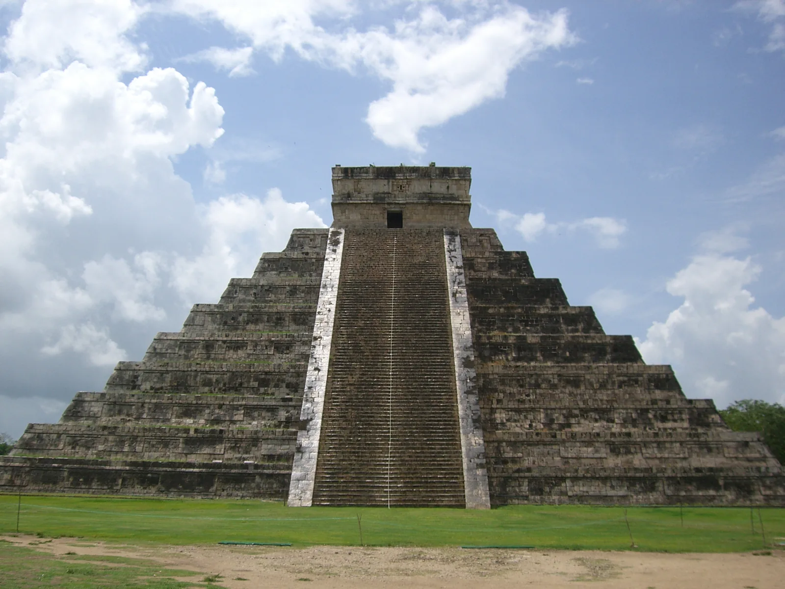
A pyramid’s silhouette is only the beginning. Follow underground water, a road connecting ceremonial spaces and the repeating sky to discover how landscape, movement and knowledge meet at Chichén Itzá.
Follow the boundary between rock and water.
Trace a route beyond the pyramid’s silhouette.
Compare repeated observations rather than one dramatic instant.
READING 01
For a moment, remove the famous pyramid from the picture. Trees, a low horizon and a broad expanse of ground remain. If you were going to build a city here, what would you ask first? Before choosing a beautiful building, you would need to know where water could be found. That question turns our gaze away from the staircase and towards a world beneath the surface.
Rain passes readily through the limestone of the Yucatán peninsula; much of its water travels underground. Cenotes are natural openings into that landscape. UNESCO places the development of Chichén Itzá near natural cavities that gave access to groundwater. A city’s location can be shaped by what lies below its streets as well as by what rises above them. [1], [7]
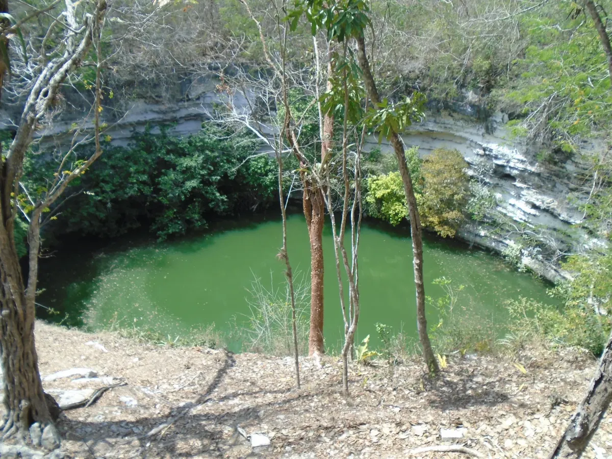
In the photograph of the Sacred Cenote, tree trunks partly frame green water and steep rock walls. Separate those foreground branches with your eye and follow the water’s edge. Instead of a river stretching towards a horizon, you see an opening within the ground. The photograph offers a starting point for thinking about that relationship, rather than a measurement of depth or water quality.
Objects and human remains recovered from the Sacred Cenote connect it with offerings and ritual. Archaeologist Enrique Vela also describes its later use as a place of pilgrimage after the city’s flourishing period. Treating it only as a reservoir would miss that history; reducing it to a frightening secret would narrow it just as much. Need, belief and landscape can meet in the same place. [7]
READING 02
Return to El Castillo. Its staircase carries the eye upwards, towards the temple at the summit. Now give the surrounding ground as much attention as the building. Imagine the plaza as a meeting place for lines of sight. Someone standing close to the steps would experience the architecture differently from someone approaching across the open space. Height is only one of the ways a building directs attention.
INAH’s site record describes major monuments on a large artificial platform. A sacbé, a prepared road, connects the principal plaza with the Sacred Cenote to the north. Water and ceremonial space therefore become more than neighbouring postcard subjects. A route joins them. The city’s stonework organised passages between places as well as the monuments themselves. [2]
Draw two points and a connecting line on your discovery card. Label one plaza and the other cenote. This is a reminder of a relationship described by a source, not a copy of an archaeological plan. Ask what movement the road made possible. One staircase can hold our gaze, but a road encourages it to leave the frame and enter the wider city.
READING 03
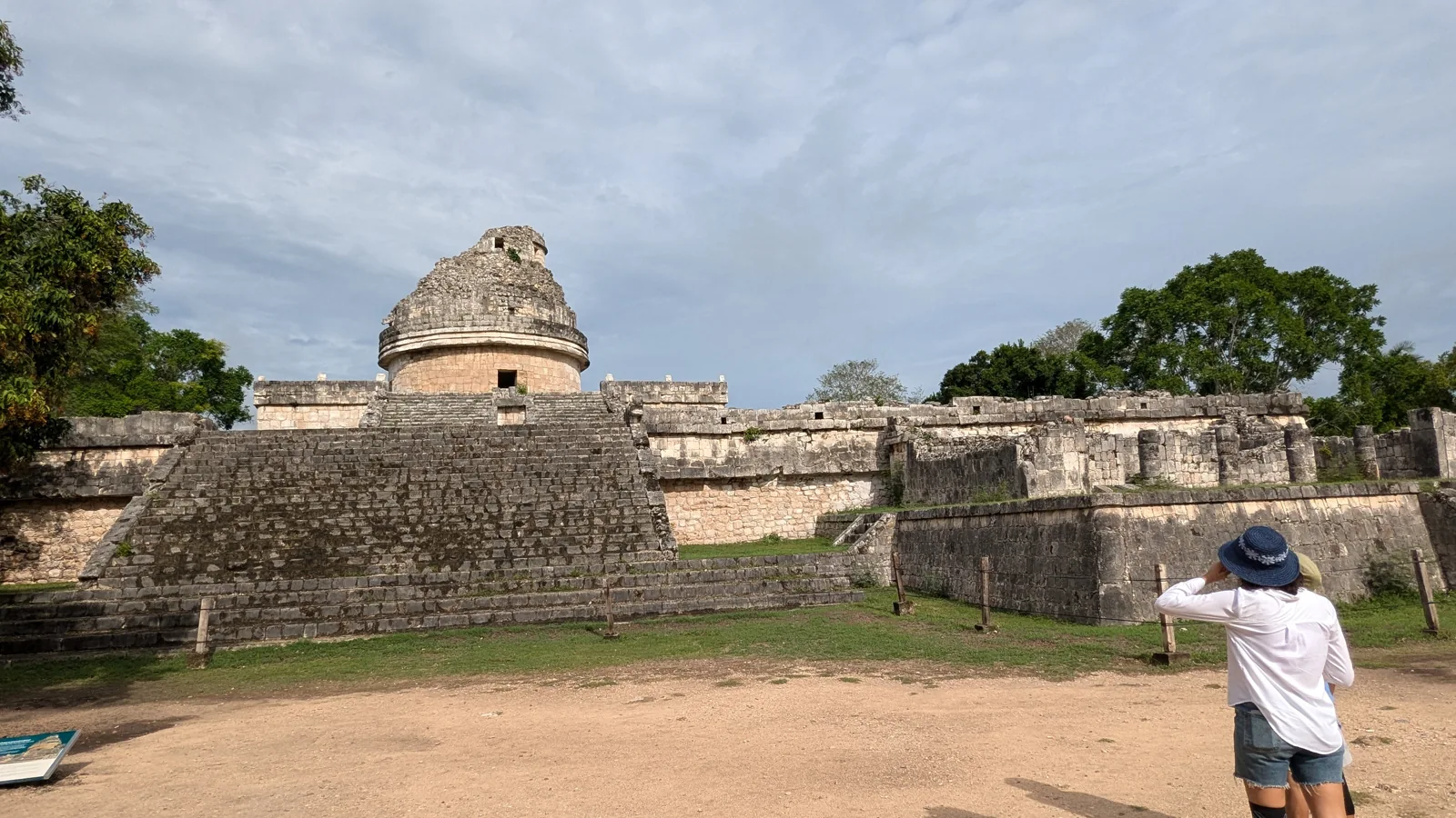
The third photograph shows a rounded tower above angular platforms. El Caracol takes its name from an internal spiral staircase. It is associated with astronomical observation, although INAH’s detailed account qualifies that function as possible. The institution also describes its present appearance as the outcome of at least six remodellings. Its silhouette need not be read as a perfectly understood instrument built in a single operation. [2]
Watching the sky was not necessarily remote from everyday work. In their 2013 study, Ivan Šprajc and Pedro Francisco Sánchez Nava relate recurring architectural orientations to sunrises and sunsets on particular dates. They propose that observational calendars could have helped organise agricultural activities and associated rituals. This is a research interpretation linking repeated horizons with tasks on the ground. [4]
El Castillo’s famous light-and-shadow effect belongs within that wider curiosity. In a published comparison of photographs taken from 15 to 29 March 2017, Šprajc and Sánchez Nava show a similar serpent-like appearance across several days. Seeing an effect and proving a design intended to identify the exact equinox are different claims. Orlando Josué Casares Contreras’s 2021 article proposes another model involving longer periods, Venus and agricultural cycles. It is presented here as a proposal, not a settled explanation. [5], [6]
These distinctions expand the spectacle rather than draining it of interest. A photograph records an appearance; understanding a building’s intended use requires dated observations and comparisons. Keep two sentences beside each other: what did my eye notice, and what explanation does the source propose? Neither sentence needs to pretend to answer every question about the ancient sky.
READING 04
What relationship can a resemblance in stone establish between distant places? That question has long accompanied Chichén Itzá. INAH researcher Marco Antonio Santos Ramírez discusses older explanations that turned similarities with central Mexico into a straightforward conquest story. He challenges the contrast between supposedly peaceful Maya and inherently warlike Toltecs, and describes alternatives involving cultural convergence and wider social transformations. Similarity alone does not establish one complete sequence of events. [3]
This distinction enriches a walk through the plaza. You can carry several questions at once: who used a road, who watched a ceremony, and how did architectural forms change? Recognising a monument is a beginning. The next step is to ask how an explanation was built and which kinds of evidence might support or revise it.
Do not confine the Maya world to abandoned stone. The Smithsonian’s Living Maya Time resource brings people, the Sun, corn, mathematics and calendars into a conversation between past and present, including Maya perspectives. Our story is not a tale of a civilisation mysteriously disappearing. It starts from an ancient city to explore continuing relationships between life, knowledge and place. [8]
Look once more at the opening photograph. Beside the pyramid, you can now think about unseen water, a connecting road and cycles beyond the frame. Leave one question on your card: which evidence would help me understand one detail better? A rewarding journey through history can continue with a better question as well as with a firmer answer.
Three ways to separate a visible detail from its interpretation. This is a reading guide, not a scaled plan or a calculated solar simulation.
Visible: Rock wall and water surface
Interpreted: Ritual and pilgrimage are explained through finds and research, not this photograph alone.
Source 7 ↗Visible: Staircase and summit temple
Interpreted: The road towards the northern cenote is described by INAH; it is outside this picture.
Source 2 ↗Visible: Round tower above angular platforms
Interpreted: Possible observational use and rebuilding history require a source beyond the outline.
Source 2 ↗The visible water does not establish ritual use. Return to the archaeological account of recovered objects and human remains. [7]
No such claim is made for this dated photograph. The researchers’ sequence compares different March days; our image is a general view. [5]
INAH describes at least six remodellings. A visible shape and a construction sequence are different kinds of information. [2]
The comparative March 2017 photographs show a similar effect over multiple days. Appearance alone cannot establish precise calendrical intention. [5]
Santos Ramírez discusses alternative interpretations of Maya–central Mexican relationships. A single conquest narrative is not treated as a settled result. [3]
Recovered objects and human remains are archaeological findings. A sixteenth-century story about virgin victims is a different type of source and not a conclusion automatically established by those finds. [7]
The serpent-like light-and-shadow effect exists; its appearance is not confined to one exact equinox date. [5]
The 2013 orientation study and 2021 Venus/agricultural-cycle model are scholarly interpretations, not identical or universally settled explanations. [4], [6]
Maya people and traditions continue. Ancient ruins do not represent a vanished people without descendants. [8]
UNESCO’s broad range for monument groups in Chichén Viejo, not a single building date for the entire city. [1]
World Heritage inscription. [1]
Publication of Vela’s visual-guide account of the Sacred Cenote. [7]
Publication of Šprajc and Sánchez Nava’s reassessment of architectural orientations. [4]
Dates of the comparative photographs discussed in the 2018 article. [5]
Publication of the equinox assessment using that series. [5]
Publication of Casares Contreras’s proposed model of longer periods and cycles. [6]
No verified Geçmişin Haritası film or Reel is available for this story. The official UNESCO/NHK film is linked at its source; it has not been copied or embedded here, and playback has not been verified.
UNESCO / NHK: official film page ↗Open the free English discovery card ↗
An original reading exercise. It neither translates nor releases any paid Turkish PDF.
Natural cavities and Chichén Viejo sixth–tenth-century building groups;1988inscription. Older conquest scenario not adopted as settled fact.
Official indexed site text after direct timeout: plaza–cenote sacbé, possible Caracol function and at least six remodellings.
Researcher’s discussion of conquest models and cultural convergence; stereotypes and a single fixed scenario rejected.
Publisher-indexed abstract and metadata after direct timeout. Orientation/calendar/agriculture proposal; full paper not read this run.
Authors’ online comparison of photographs15–29March2017; visible effect not an exact equinox-day marker.
Publisher abstract and metadata read, not full manuscript.2014–2018observations, longer intervals and proposed Venus/agricultural model.
Author’s online excerpt: groundwater, offerings, human remains and later pilgrimage; full printed guide not read.
Official teaching resource overview: Maya people,Sun,corn,mathematics and calendars; external videos/interactives not played.
Official UNESCO/NHK film source page only. No copying, embedding or playback verification.
Original narrative and English edition: Geçmişin Haritası. Sources checked 28 October 2026. Photographs date from 2006, 2015 and 2024; they do not show current visitor conditions. Source-access limits are stated below. Image licences are separate from the rights in this original narrative.
Smithsonian: people, Sun, corn and calendars ↗
This external resource has not been interaction-tested in this edition.