
Sigiriya: The City Around the Rock
Short summary
Water, stone and changing levels shape the approach to Sigiriya. Four chapters explore this landscape, the paintings and the visitors who left words behind.
The ground matters as much as the rock
In a photograph, the highest point usually catches your eye. At Sigiriya, the rock does this effortlessly. Pause before imagining the climb. Think instead of pools, crossings and the changing ground around it. Does a city impress us only through height, or also through the way it draws us closer?
UNESCO associates this Sri Lankan capital with King Kassapa I, whose reign dates to 477–495. Its description places the remains on the slopes and summit. The site therefore asks for a wider view than a single image of a rock. The buildings above and the approach below belong to the same landscape. [1]
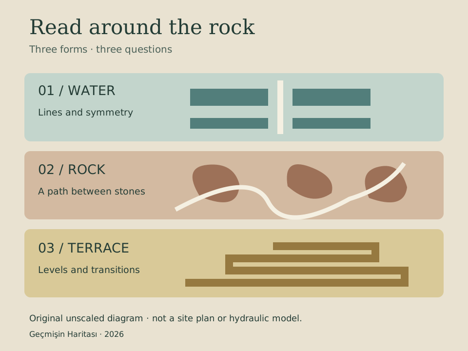
The Department of Archaeology presents the paintings, Lion’s Paws Terrace, royal palace and Mirror Wall as distinct features. Here we begin with the gardens. Our original diagram is a reading aid, not a measured plan: it invites attention to water, stone and changes in level. [4]
Water shapes the space between
The Central Province Tourism Department describes the western water gardens through their symmetry, pools and connecting routes. Imagine standing at a pool’s edge. The boundary of the water also helps define where a person can walk. Water becomes part of the arrangement of space. [3]
The same account connects the gardens along an east–west axis with the outer moat and an artificial lake south of the rock. It describes underground conduits linking the pools. The visible surface and the hidden route are parts of one system. Asking how water arrived changes a view into a question about design. [3]
The Central Cultural Fund also discusses linked pools, channels and fountains. Institutional descriptions of seasonal operation do not amount to a flow test carried out by us today. The question here is how a garden makes water useful and visible at once. [2]
From straight lines to winding paths
Do not expect one geometry throughout. The official garden account distinguishes winding paths between large natural boulders from the water gardens and the terraces. Your way of reading the place changes: symmetry matters in one area, movement between stones in another. [3]
A turn can reveal a space that was hidden a moment earlier; a terrace can lift the viewpoint. These are prompts for observation, not reconstructed scenes claiming what a particular ancient visitor saw. Which detail becomes visible only as you move?
The Tourism Department relates the terraces to the natural slope and built retaining walls. The summit is no longer an isolated destination. Thinking about the lower gardens, the paths and the rising levels together reveals a rhythm of approach as well as a change in height. [3]
Seeing a face, asking a name
Sigiriya’s paintings give the rock another kind of surface. The Central Cultural Fund lists different interpretations of the female figures, including celestial beings, members of a royal circle and goddesses. Several interpretations do not establish several certain identities. Seeing a face is not the same as knowing a name. [2]
The institution also describes the polished plaster of the Mirror Wall and the words left by later visitors. People who looked at the site added traces of their own. The meaning of a place can extend beyond the period in which it was first used. [2]
UNESCO’s inscription in 1982 belongs to a much later framework of heritage protection. A ruler’s period, visitors’ texts and a modern listing should remain distinct. Return to the opening question: is the rock most compelling, or the world of water, paths, images and memory around it? [1]
Evidence and interpretation
Is the diagram an actual site plan?
No. It is an original, unscaled guide to three garden forms. It does not locate structures precisely.
Are the painted women securely identified?
The Central Cultural Fund presents several interpretations. The figures are visible; their identities remain debated. [2]
Have we checked that the fountains work today?
No. Seasonal operation is described by the sources; we have not tested current water flow. [3]
Timeline
Open the free discovery card ↗
No verified video from our account is available for this story.
Sources
- UNESCO · Ancient City of Sigiriya
- Central Cultural Fund · Sigiriya
- Central Province Tourism Department · Sigiriya Gardens
- Department of Archaeology · Sigiriya
Original narrative and translation: Geçmişin Haritası. Sources checked 24 October 2026.