
Follow a waterfront, a route and a building through time
A harbour hidden in a plain
Begin with an absence. In a harbour city we expect water to organise the view: a shore to approach, a place to land, an edge between solid ground and a moving surface. At Miletus, the question is how to read that relationship when the present landscape no longer supplies the scene we expect. Imagine following a route toward a harbour and then having to redraw the final part of the journey. This is a reading exercise, not a recovered ancient itinerary.
The University of Hamburg excavation project explains the former peninsula through the changing Latmian Gulf and sediments carried by the Büyük Menderes. It places the beginnings of silting in the fourth and third centuries BCE and says direct access to the sea had disappeared by the Middle Ages. Lake Bafa preserves a remnant of that gulf. These are changes across time, rather than a single moment when the sea suddenly withdrew. [1]
Geoarchaeology gives this missing waterfront a different kind of archive. The university-hosted abstract of a 2006 research paper describes sediment cores and several forms of environmental evidence. It relates the landscape to delta growth, sea-level change and human activity. The abstract also distinguishes deliberate filling around the urban centre from later harbour infilling. We have read the abstract, not the full paper; its broad reconstruction is not a licence to draw a precise shoreline for any chosen year. [2]
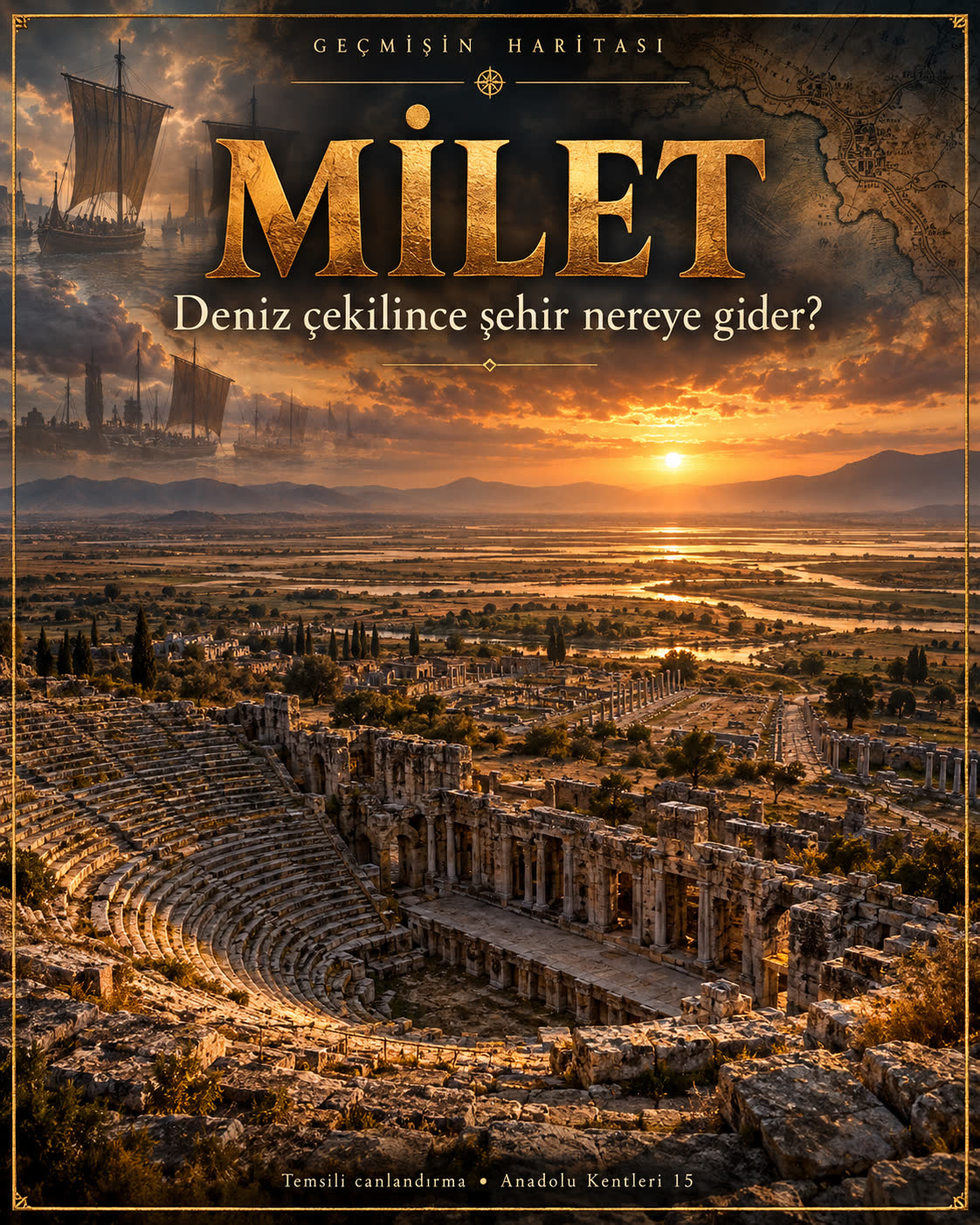
Our existing cover is an artistic invitation to this enquiry. It cannot measure where water stood. A useful first note therefore has two lines: what the image makes you imagine, and what a dated environmental study could establish. The distance between those lines is where a compelling story becomes an investigation.
From landing place to public space
A harbour is not simply a blue shape beside a town. Think about the change from arriving to belonging: a traveller must find a route, a place to exchange something, a destination recognised by others. These are possibilities to investigate, not a claim that one particular journey has been recovered. They help us ask why a waterfront and a street should be read together rather than photographed as unrelated monuments.
The excavation project describes the centre through the Lion Harbour, an avenue and markets. The Delphinion, council building and other public structures gave that area several roles. The account also notes that the street grid is not aligned exactly north–south. Order on a plan need not mean alignment with the edges of a modern page. Follow the relationships between entrances and spaces before trying to make the city fit an ideal diagram. [3]
There was also a route outward. The project identifies the Delphinion as the starting point for an annual procession to Apollo at Didyma, along a sacred road of about sixteen kilometres. It describes enlargement and paving under Trajan. [3] Movement here could connect a harbour city with a sanctuary beyond its immediate streets. An economic centre and a ritual landscape are not separate worlds simply because our guidebook gives them different headings.
Try changing the scale of your mental map. First place the harbour and the avenue; then add one building; finally trace a connection beyond the city. What disappears when you zoom out, and what becomes visible? This is our own comparison exercise. It asks the reader to make the transitions explicit, rather than to fill every unrecorded street with invented merchants or processions.

The audience leaves; the building remains
A theatre invites us to imagine a crowd. Yet the most revealing question may come after the imagined audience has gone home. What happens to a large, solid structure when the needs of a settlement change? A building does not lose all usefulness when it loses the activity for which it was first arranged. At Miletus, looking for that second life changes the way we read the stone seating.
The excavation project traces a Hellenistic theatre through Roman rebuilding and later Byzantine use. It explains the original location through a hollow in the slope, and the theatre’s orientation through that terrain rather than strict conformity to the street grid. The visible structure is the result of successive alterations. It is therefore misleading to give every surviving wall one shared construction date. [4]
In Byzantine times, the former seating area accommodated houses and a chapel, and defensive works transformed the complex. The project describes reuse of building material and the relationship with the later settlement on Kaletepe. [4] To read this history, do not stop at naming a period. Ask how the same enclosure could organise spectators at one time and offer protection at another. That question concerns changing use, not merely a change of architectural style.
Tomisti’s photograph supplies a dated view of the surviving theatre. Its record gives the year 2011 and a CC BY-SA 4.0 licence; the upload in 2019 is a separate event. [7] Look for the spatial arrangement before adding voices to it. The photograph records neither an ancient performance nor a medieval emergency, and it should not be treated as a live report of access or conservation conditions today.
A city beyond its most famous age
Leaving a monumental ruin can feel like reaching the end of its story. A museum offers a different ending: small objects, labels and findspots can bring the scale back down from a landscape to a hand. The question becomes not only what stood here, but how different kinds of surviving material let us recognise the people and activities behind the buildings.
The official Culture Portal identifies Hellenistic, Roman, Eastern Roman and Turkish-period remains at Miletus. It also describes the village at Balat continuing until the earthquake of 1955. [5] That later history matters. The end of an ancient harbour relationship is not the same event as the end of every settlement on the site. One short phrase about a lost port cannot stand in for all those different changes.
The museum account brings material from Miletus together with finds from Priene and Didyma. It distinguishes garden displays from indoor displays, and explicitly identifies a Minoan kitchen presentation as a reconstruction. [6] This gives us a practical reading method: keep place of discovery, period of the object and form of display on separate lines. A reconstructed setting can help an audience understand an object without becoming the object’s original context.
Finish with four entries in your notebook: one change in the landscape, one connection between places, one building whose use changed, and one claim that needs a different kind of evidence. Miletus is not only a city from which the water has gone. It is a place where the meaning of a route, a wall or a museum label becomes clearer when we ask what changed around it.
Different dates, different histories
- Fourth–third centuries BCE
- The excavation landscape account places the beginning of gulf and harbour silting in this broad period. [1]
- Hellenistic period
- An early theatre phase preceded the Roman rebuilding; individual phases require separate dating. [4]
- Roman period
- The centre and theatre underwent alterations; the sacred road was enlarged and paved under Trajan. [3][4]
- Middle Ages
- The landscape account says Miletus no longer had direct access to the sea. This is not a date for all occupation ending. [1]
- Byzantine period
- Housing, a chapel and fortifications changed the use of the theatre complex. [4]
- 1955
- The Culture Portal connects the end of the village occupation at the ancient site with this earthquake. [5]
- 2011
- Year given for Tomisti’s theatre photograph; its upload in December 2019 is a different event. [7]
Fact, interpretation and tradition
Coast change, not a single retreat
Delta growth, changing sea level and human interventions require different questions. A modern view does not fix an exact ancient shoreline. [1][2]
Later occupation, not instant disappearance
A lost harbour connection is not the end of every settlement phase. [5]
Building phases, not one date
Theatre, Roman alterations and Byzantine refuge belong to distinct episodes. [4]
Display and original context
A reconstructed museum setting is an interpretation, not an untouched ancient room. [6]
Illustration and photograph
The owned cover is illustrative. The 2011 theatre photograph records surviving fabric, not an ancient event. [7]
Three ways to read Miletus
Read an absence
What evidence would you need to locate a former waterfront rather than merely imagine it?
Follow two routes
Compare an arrival through a harbour with a route to a sanctuary. Which source supports each connection?
Keep the building, change the use
Describe how one structure can serve different needs without assuming that every wall belongs to the same phase.
Film and image status
No verified Geçmişin Haritası Miletus Reel or master video has been located for this edition. No video is embedded and no playback check is claimed. The cover is an owned artistic illustration. The theatre is a licensed photograph dated 2011; its upload date is a separate event.
The existing Turkish publication dataset links this Miletus Instagram post ↗. This is a post reference, not a verified Reel, video or performance ranking. No current views, likes, comments or private Insights are verified.
Reading files and delivery language
This complete English web story includes an original free worksheet. It does not claim that a paid Turkish PDF has been translated or made freely available.
Seventeen-city collection · Turkish ↗ · Troy in the Anatolian series · Turkish ↗ · Sardis · Turkish ↗
Follow the evidence
Sources and photo-rights records checked 30 October 2026. Report dates and photograph dates are identified separately from ancient dates. No current visitor-access claim or new decipherment update is implied.
- Miletus Excavation, University of Hamburg · The Milesian landscape
Former peninsula, silting, medieval loss of direct sea access and Lake Bafa. No exact palaeoshoreline is mapped here.
- Brückner and colleagues (2006) · From archipelago to floodplain
University-hosted abstract and bibliographic record only; full article not read. Multiple environmental processes and human activity are distinguished.
- Miletus Excavation · City Center
Spatial relationships and the procession route to Didyma; quoted bibliography not separately read.
- Miletus Excavation · Theater and theater fortress
Phases and changing uses of the theatre. No present visitor-access or safety guarantee is inferred.
- Türkiye Culture Portal · Milet archaeological site
Periods visible at the site and later Balat occupation. Foundation traditions and sweeping philosophy claims are not adopted as demonstrated facts.
- Türkiye Culture Portal · Milet Museum
Regional find groups and reconstruction/display distinction. Current hours and ticket prices not checked.
- Wikimedia Commons · Miletus theatre 01, Tomisti
2011 author date, 2019 upload and CC BY-SA 4.0 rights record.

Photo licences apply to their identified images, not to the entire original story. A CC BY-SA theatre photograph is referenced externally. The existing local cover is illustrative; no original, video master or paid file was modified.